Arctic relapse now, spring fever 50s next week?

Weather Whiplash 101
Step right up! Another Minnesota weather roller coaster ride is just ahead.
Tuesday's quick hitting morning rush hour snow delivered as advertised. Now we brace for a 48-hour arctic relapse with sub-zero chills.
Then the thaw kicks in Friday afternoon, building to snow-eating 50s and bare grass again next week? Throw in some rain and potential thunder by the weekend of March 14-15 and you have the makings of an early spring.
Create a More Connected Minnesota
MPR News is your trusted resource for the news you need. With your support, MPR News brings accessible, courageous journalism and authentic conversation to everyone - free of paywalls and barriers. Your gift makes a difference.
Yes, I still think winter as we know it is over by Friday afternoon.
Hang in there.

Snow delivers
Snowfall totals ranges from one to four inches across the wider Twin Cities metro Tuesday. Here's the map from the Twin Cities National Weather Service.

The models did a good job with this system. NOAA's newly upgraded Global Forecast System was on the money with the notion of a deeper three to six inch snowfall through central Minnesota. I really like the look of this upgraded model product so far. Here's a wider look at snowfall totals across Minnesota.

Snow done — cold next
People always ask when our last sub-zero temperature in winter is going to be. My answer is always the same for the metro, first week of March. There's usually enough fresh snow cover to radiate well at night and one more shot of arctic air this week.
We awake to sub-zero temperatures and chills across the Upper Midwest Wednesday and Thursday morning.

We bottom out Thursday morning, then milder Pacific breezes send temperatures higher as we move through the weekend.

Spring Fever outbreak next week
Spring seems determined to arrive early this year. Pacific air, southerly breezes, disappearing snow cover and a higher March sun angle combine to push temperatures into spring thaw territory. Check out the warm bias building over the Midwest early next week courtesy of the University of Maine's Climate Reanalyzer.

There are still major model differences in just how warm it will get in Minnesota next week. That's not surprising. Models have a difficult time dealing with unseasonable extremes. That's one reason most forecasters underestimate extreme events. Another reason is nobody wants to be the forecaster out on the proverbial limb if the event turns out not to be that extreme. Meteorological group think. I call it "forecasting on the 9's." Why forecast 50 degrees when 49 will do? "My audience won't grill me if it actually hits 50 degrees, but if I forecast 50 and it only hits 49 -- they will!?"
I tend to call extremes as I see them coming. I'm not one to back off a forecast because of a seemingly safer conservative approach, even though all meteorological signs point to an extreme event occurring. I just don't feel that serves my audience. I'd rather take my lumps when I'm wrong and know I gave listeners my absolute best shot. Caution to the wind so to speak? Let's see how much egg I'm scraping off my face with my prediction of an early spring thaw next week. This profession has a way of keeping us humble and reminding us we are imperfectly human.
Now please excuse me while I crawl out a little further onto my weather limb.
NOAA's GFS cranks out 50 degrees by next Tuesday.

The European Model (ECMWF) is still by far the most aggressive with next week's warm surge. The Euro brings 40s as soon as this weekend, a string of 50s next week and even 60+ by next Thursday.

Though not the most likely scenario, that could happen if all the snow is gone and everything falls just right. Right now I'd say 40s are a lock next week, 50s are likely and 60 is an outside shot.
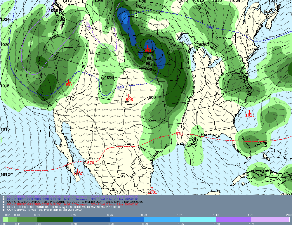
Thundery Ides of March?
The longer-range GFS spins up a potent but warm April-like system by the weekend of March 14-15. If this is close, rain -- and even some thunderstorms could be visiting us early this year.
Stay tuned!